blah blah blah
Silver Mountain
Length: 1.2 miles out-and-backDifficulty (click for info): Beginner
Elevation Gain: 550 feet
Rating (click for info): 6/10
Elevation: 2160'
Prominence: 449'
Driving Directions:
Trailhead and parking area are on South Road (a dirt road), in Lempster, NH. To get there, take Lempster Mountain Road (the continuation of the 2nd NH turnpike) from the east side of Rt. 10 in the center of Lempster, 5.1 miles south of Rt. 31 and 4.5 miles north of Rt. 123A. Drive 1.6 miles down Mountain Road, then turn right onto South Road. Use caution, as South Road becomes very narrow and rough. The parking area is on the left side of a field 2.0 miles down the road. Click here for a Google map.
Trail Map
About the Hike:
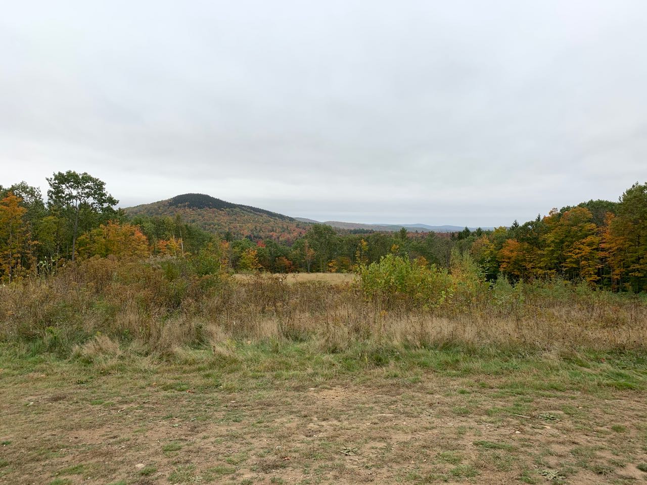
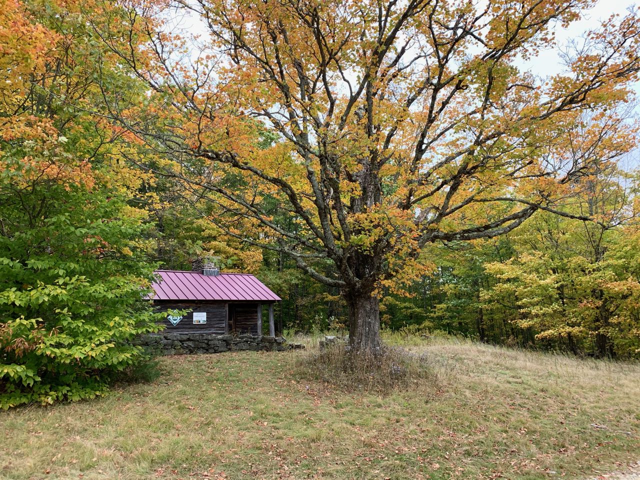
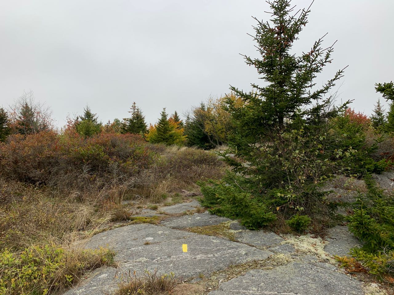
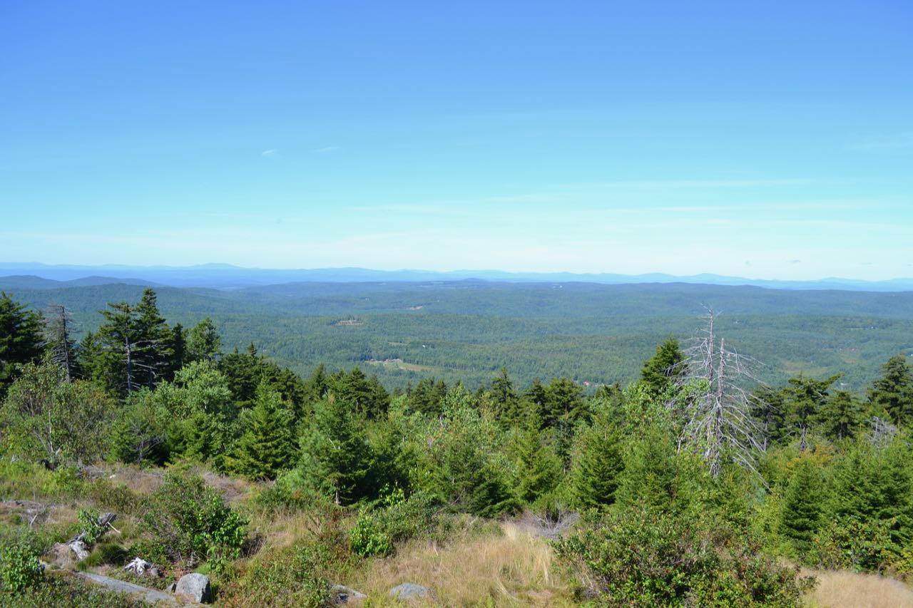
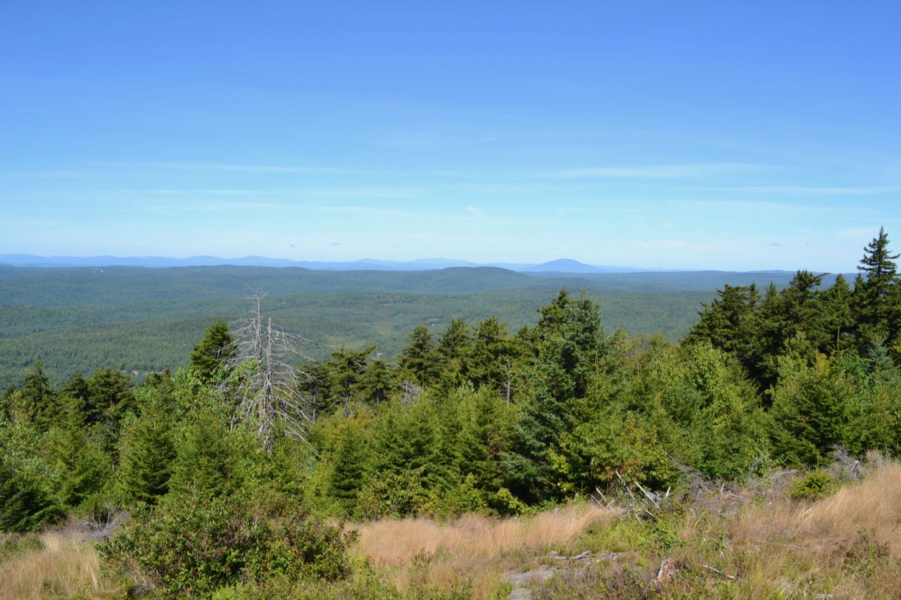
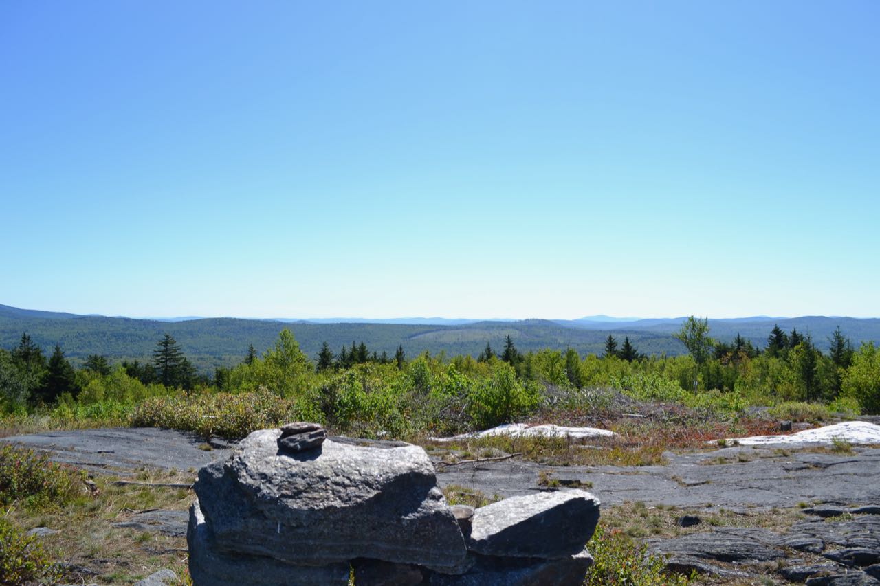
Silver Mountain, located within the Forest Society's Ashuelot River Headwaters Forest, has one of the best views you can find for the minimal effort required. It has panoramic views in three directions from its flat, rocky summit. Right at the start of the hike, you can already enjoy some fine scenery. There is a nice view from the large clearing around the parking area out to nearby Huntley Mountain in Marlow, and the clearing has a large stone wall and a cabin. The unnamed trail to the summit begins on the right side of the road, opposite the second entrance to the parking area. Look for the chainlink gate across it and the Forest Society sign on a tree. The trail ascents easily through pleasant forest for 0.2 miles, then joins a woods road coming in from the left. Watch for this intersection when you return, as it is easy to miss the turnoff back to the left. In 0.05 miles further, the trail departs the woods road to the left and begins climbing at a moderate pace. It leads uphill over a few rocks under a canopy of large pines for a quarter mile. The grade becomes easy again and the trail emerges in a ledgy and brushy area. It takes you through the very large meadow atop the broad summit plateau for the final 0.1 miles to the summit. Follow blazes carefully, as the trail can be overgrown in this section. The summit, on a wide open rock ledge, is marked with a combination cairn/chair. From the summit, there is a nice view of all the surrounding hills, extending out to the Green Mountains in Vermont. The view is open in most directions, with the exception of small areas to the north and south blocked by trees. Off to the east, Lovewell Mountain can be seen nearby, as well as Mt. Kearsarge in the distance.
Printable directions page